Knowing the precise locations of offshore wind farms is crucial for future project development. When combined with our comprehensive tracking of related market intelligence, you gain a fuller picture of the industry, equipping you with the insights needed to stay ahead and identify new opportunities.
WindMap GIS
Map your opportunities
Accurate location matters
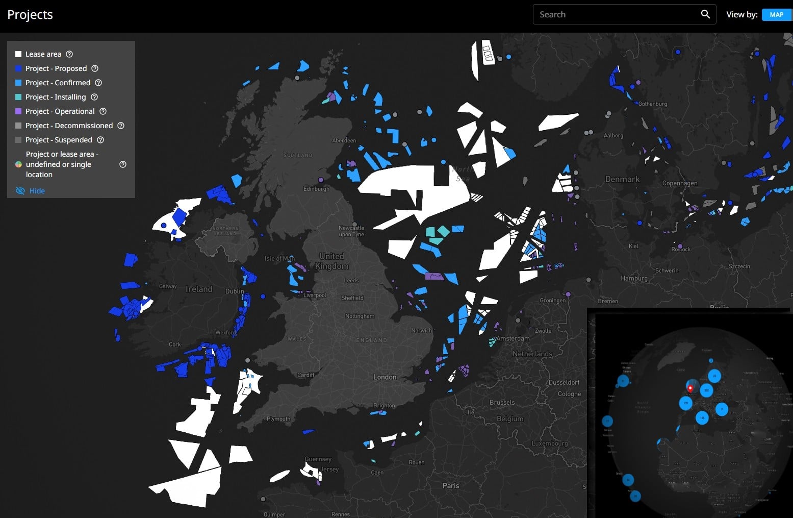
Our constantly updated API provides real-time access to offshore wind farm boundaries, guaranteeing you always have the most up-to-date data without delays. Each boundary file contains an attributes table with essential project details.
Global coverage of the GIS Offshore Wind Farm Boundary API

Quality Offshore GIS Boundaries Data
A subscription-based API providing accurate, up-to-date offshore wind farm boundary data worldwide.

API Connection
1,700+ offshore wind farm project boundaries/ 290+ lease area boundaries

GIS Attribute Coverage
Project name & Country
Developer(s) , Project status & Operations date
Project type & Capacity
Number of turbines & Max water depth

Benefits
Stay informed on project locations and updates
Optimize navigation and operational planning
Enhance logistics and resource allocation
Access critical site information for project planning
Disclaimer, Terms and Conditions
The data and estimates provided on this Platform reflect Esgian’s assessment at the time that they are made available as part of the Service. No guarantee can be given that such data and estimates are accurate. The data is provided for its intended recipients only and shall not be published or circulated to a third party without our prior written permission. Whilst Esgian AS has endeavored to provide accurate and reliable data, no liability with respect to its completeness or accuracy is accepted. Any reliance on the data and estimates is done on your sole risk.
Upon accessing the Service you accept our Terms and Conditions which we encourage you to read carefully. These can be changed at any time, and the latest version can be found here.
Who needs WindMap GIS ?
Esgian’s global GIS Offshore Wind Farm Boundary API market intelligence tool IS perfect for offshore wind farm developers, vessel owners, service providers, equipment makers, shipyards, banks, insurance companies and investment funds who need to track developments and trends in the offshore wind market to support contracting, business development, investments, and competitive analysis.
How do you ensure data quality?
Esgian’s Wind Analytics’ team of analysts and database services veterans continuously monitors, tracks, and interacts with its offshore wind industry network to ensure that our data is updated and accurate.
How can I get user support or more information about subscriptions?
For technical support, questions regarding usage of the site, or to report issues with the site, contact us. Regarding Wind Analytics subscriptions and pricing, note that these are normally valid for a one-year period, but we may offer discounts for multi-year subscriptions. For more information, please contact us so we can find the right solution for you.